Without going into how bad their last update was...
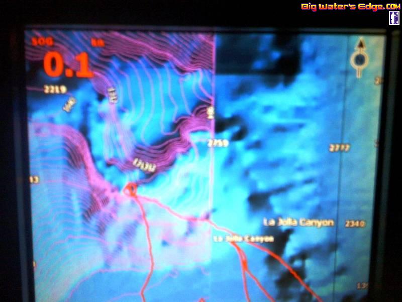
Lowrance has had an issue with their maps; I.E. leaving the bathemetry and all details including satellite imagery of bottom details cut out of areas of their current maps... From the LaJolla point out 1/2 mile or so and up past solona beach. Even their main map at their head quarters is missing this information. Their engineers and customer service reps have both confirmed the issue is affecting all units, but failed to return several of our calls to, at the very least, explain this. Units as expensive as the HDS5, 7 and Elite 5 should have complete maps as they are advertised to with the Nautic insight. None of us should not have to go purchase the navionics after spending money for faulty software from Lowrance's Nautic insight. My Raymarine 545s, and the Garmin GPS units I own both have very detailed maps of the area.
Notice the loss of the pink bathemetry lines and spot depth markings in the area I mentioned above in the photo below.
Ignore the track log... nothin to see here.